Yorketown
The salt-lake crossroads of the southern Yorke.
The service hub of the southern Yorke Peninsula, laid out in 1872 among more than 200 salt lakes that once supported a thriving salt-harvesting industry.
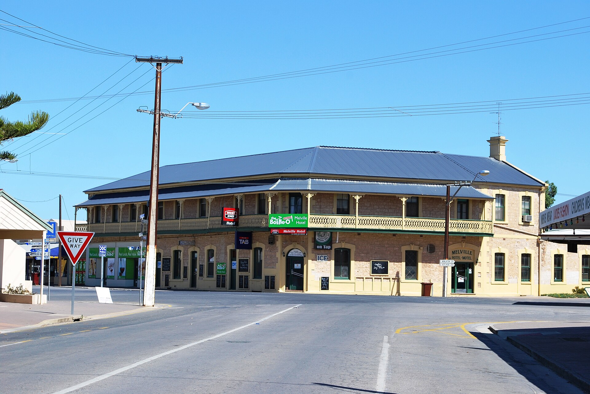
Every road on the bottom end of the peninsula seems to lead to Yorketown, the crossroads town that has served the surrounding wheat, barley and sheep country since it was laid out in 1872. The Melville Hotel was already pouring beers when the first town blocks were sold, and the town — plain "Yorke" in its earliest years — took its present name in 1876.
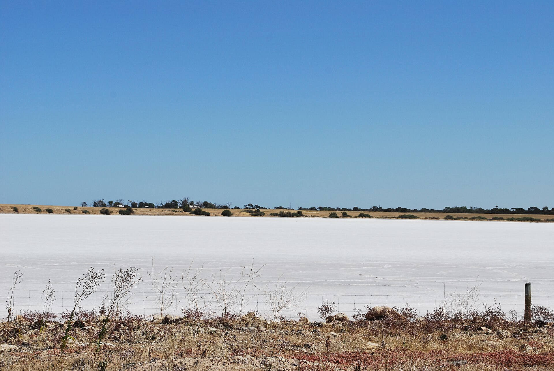
What makes Yorketown genuinely strange and wonderful is its setting: the town sits among more than 200 salt lakes, scattered across the southern Yorke like shards of mirror. For a century the lakes were worked commercially, with salt scraped, bagged and carted to the port at Edithburgh; during the Second World War the district produced as much as 57,000 tonnes in a single year. The industry is gone, but in the right season several lakes still blush a photogenic pink.
Today Yorketown is the practical base for exploring the salt lake country and the south coast — a town of wide streets, heritage stone shopfronts, a good bakery and country pubs, with Innes National Park, Edithburgh and the surf coast all within easy reach.
Find it on the map
Got a photo of Yorketown?
Share your best shot. If we use it in the gallery, you'll be credited by name. Photos are reviewed before going live.
Last verified 1 day ago
Within a short drive
Places within 5km of Yorketown
You might also like
Similar experiences across Yorke Peninsula
Image credits
- Yorketown.JPG by Mattinbgn , CC BY-SA 3.0 via Wikimedia Commons